
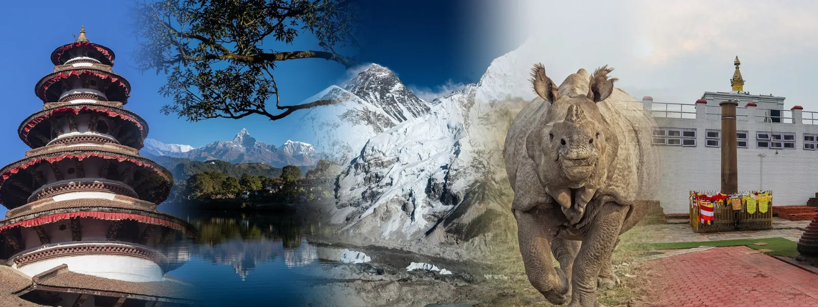
Nepal is a small country with an unusually long list of reasons to visit. Within a few hundred kilometres, the land climbs from hot Terai grassland barely above sea level to eight of the world's fourteen peaks above 8,000 metres. In between sit medieval royal squares, the birthplace of the Buddha, jungle where rhinos still wade through rivers, turquoise mountain lakes and hill towns where the main street is a stone-paved lane.
The twenty places below run roughly from the ones most first-time visitors include to the quieter corners that reward a longer stay. Each entry notes where the place is, when it looks its best and how much time it deserves. Very few trips cover all twenty, and that is part of the appeal. Nepal rewards choosing a handful and moving slowly.
Kathmandu Durbar Square
 The Taleju Temple rising above the market stalls of Kathmandu Durbar Square. Photo: Aayusha Dangol / Wikimedia Commons / CC BY-SA 4.0
Kathmandu's old royal square is where the capital's history sits closest to the surface. Hanuman Dhoka, the former palace complex, is ringed by Newar-style temples with carved wooden struts, tiered roofs of brick and timber, and courtyards that have hosted coronations, festivals and markets for centuries. The Kumari Ghar is the home of the Kumari, a young girl worshipped as a living goddess, who sometimes appears at an upper window. The wooden pavilion called Kasthamandap, from which Kathmandu is often said to take its name, was rebuilt after the 2015 earthquake.
The square belongs to the Kathmandu Valley World Heritage Site, listed in 1979 as seven separate monument zones. The 2015 earthquake damaged all of them, and repair work has been uneven, so scaffolding and unfinished corners are still part of the scene. Foreign visitors pay an entry fee. Early morning, before the tour groups arrive, is the calmest time, and the bazaars of Indra Chowk and Asan just beyond the square show everyday Kathmandu at full volume.
- Where: Central Kathmandu
- Best time: October to November, March to May
- Time needed: Half a day
Pokhara and Phewa Lake
 Phewa Lake and Machhapuchhre, seen from the World Peace Pagoda above Pokhara. Photo: Rajivkilanashrestha / Wikimedia Commons / CC BY-SA 4.0
Pokhara is the place where Nepal slows down. The town spreads along the edge of Phewa Lake, and on a clear morning the white wall of the Annapurna range rises behind the water, with the sharp, forked summit of Machhapuchhre, the Fishtail, in the middle. Machhapuchhre stands at 6,993 metres. It is regarded as sacred and is closed to climbing, so its top has never been officially reached. Painted wooden boats cross the lake to Tal Barahi, a small temple on an island, and a forest trail climbs to the World Peace Pagoda, a white stupa built by a Japanese Buddhist order on the ridge above the water.
Beyond the lake, Sarangkot is the classic sunrise viewpoint, and the hills above town are among the most popular places in Nepal for paragliding. Davis Falls, known locally as Patale Chhango, drops into a narrow tunnel in the rock and carries the name of a Swiss visitor said to have drowned there in 1961. The Lakeside district keeps cafés, bookshops and guesthouses within easy walking distance, and many Annapurna treks begin or end here.
- Where: Gandaki Province
- Best time: October to November, February to April
- Time needed: 2 to 3 days
Everest Base Camp and the Khumbu
 Everest and Nuptse above the Khumbu Glacier in Sagarmatha National Park. Photo: Vyacheslav Argenberg / Wikimedia Commons / CC BY 4.0
No other trek in Nepal carries quite the weight of the walk to Everest Base Camp. The route usually begins with a flight to Lukla, then follows the Dudh Koshi valley north through Sherpa villages, past mani walls and across high suspension bridges to Namche Bazaar, at about 3,440 metres. From there the trail climbs through Tengboche, Dingboche and Lobuche to Gorak Shep, the last settlement, and on to Base Camp at 5,364 metres.
Everest itself, measured jointly by Nepal and China in 2020 at 8,848.86 metres, is hidden behind nearer ridges from Base Camp. Most trekkers climb Kala Patthar, a rocky ridge at about 5,545 metres, for the famous view of the summit. The round trip covers roughly 130 kilometres and usually takes 12 to 14 days, with rest days for acclimatisation built in. Altitude is the real challenge, far more than distance. The trail lies inside Sagarmatha National Park, a UNESCO World Heritage Site, and permits are required. In busy seasons, flights to Lukla sometimes leave from Ramechhap instead of Kathmandu. Anyone who prefers to stay low can see Everest on a mountain sightseeing flight from the capital.
- Where: Solukhumbu District
- Best time: March to May, October to November
- Time needed: 12 to 14 days
Chitwan National Park
_4.jpg/960px-Indian_rhinoceros_(Rhinoceros_unicornis)_4.jpg) A greater one-horned rhinoceros beside the Narayani River in the Chitwan area. Photo: Charles J. Sharp / Wikimedia Commons / CC BY-SA 4.0
A greater one-horned rhinoceros beside the Narayani River in the Chitwan area. Photo: Charles J. Sharp / Wikimedia Commons / CC BY-SA 4.0
In the warm lowlands of the central Terai, Chitwan National Park protects one of the last good places in Asia to see the greater one-horned rhinoceros. Established in 1973 as Nepal's first national park and listed by UNESCO in 1984, it covers roughly 950 square kilometres of sal forest, tall elephant grass and braided rivers. Besides rhinos, the park shelters Bengal tigers, which are far harder to spot, along with gharials, sloth bears, deer and hundreds of bird species.
Most visitors stay in Sauraha, on the edge of the park, and spend two or three days on jeep safaris, canoe rides along the Rapti River, guided jungle walks and visits to Tharu villages. The Tharu are the Terai's indigenous community, and their cultural shows often include a stick dance. Elephant-back rides have drawn criticism over animal welfare, and many lodges and visitors now prefer to explore on foot, by jeep or by canoe.
- Where: Chitwan District, Terai
- Best time: October to March
- Time needed: 2 to 3 days
Lumbini
 The Maya Devi Temple at Lumbini, the traditional birthplace of the Buddha. Photo: Ricky Partel / Wikimedia Commons / CC BY-SA 4.0
Lumbini is where, according to Buddhist tradition, Siddhartha Gautama was born. UNESCO inscribed the site in 1997, and it centres on the Sacred Garden, a quiet, flat expanse of lawns, brick ruins and old trees. The Maya Devi Temple, built over the remains of much older shrines, marks the traditional birthplace, and a stone marker inside points to the exact spot. Beside it stands an Ashoka pillar, raised by the Mauryan emperor Ashoka around 249 BCE. Its inscription records that he visited the place and worshipped there because the Buddha was born in it. The pillar was lost for centuries and rediscovered in the 1890s.
Beyond the Sacred Garden spreads the wider monastic zone, where Buddhist communities from many countries have built monasteries in their own national styles, among them Cambodian, German, Korean and Thai. The site is large and flat, and bicycles or rickshaws make it easier to cover. Buddha Jayanti, the Buddha's birthday, falls on the full moon of April or May and brings the biggest crowds. In the hot months from April to June, the Terai heat makes early mornings the only comfortable time to walk.
- Where: Rupandehi District, western Terai
- Best time: October to March
- Time needed: 1 day
Annapurna Region
The Annapurna Conservation Area, at about 7,629 square kilometres the largest protected area in Nepal, holds some of the most varied trekking in the Himalaya. Rhododendron forest, terraced Gurung and Magar villages, glacier-fed rivers and high desert all appear within a few days of walking. The headline routes are the Annapurna Circuit, which crosses Thorong La at 5,416 metres, and the Annapurna Base Camp trek, which ends at about 4,130 metres inside a ring of peaks. The Kali Gandaki valley, often described as one of the deepest river gorges in the world, runs between the Dhaulagiri and Annapurna massifs.
 Sunrise from Poon Hill, with the Dhaulagiri and Annapurna ranges along the horizon. Photo: Bijay Chaurasia / Wikimedia Commons / CC BY-SA 4.0
For those with less time, the Ghorepani Poon Hill trek is the classic short option. It reaches a hilltop viewpoint at around 3,200 metres, where many trekkers gather before dawn to watch the first light reach Dhaulagiri, Annapurna South and Machhapuchhre. A permit for the conservation area is required, and tea houses along the main routes provide food and beds.
- Where: Gandaki Province
- Best time: March to May, October to November
- Time needed: 4 to 21 days, depending on the route
Boudhanath Stupa
 Boudhanath Stupa by moonlight in September 2015, with scaffolding around the spire during its rebuilding after the earthquake. Photo: Christopher J. Fynn / Wikimedia Commons / CC BY-SA 4.0
Boudhanath is one of the largest spherical stupas in the world and the centre of Tibetan Buddhist life in Kathmandu. Painted eyes gaze out from the gilded tower above the white dome, and a ring of prayer wheels, shops and cafés circles the base. Pilgrims walk clockwise around it from dawn until late evening, spinning the wheels, murmuring mantras and lighting butter lamps. More than fifty monasteries stand in the surrounding streets, and the neighbourhood has become home to a large Tibetan community.
The 2015 earthquake badly damaged the gold spire, although the dome itself came through largely intact. A privately funded rebuilding project took about eighteen months, and the stupa reopened in November 2016. Evening is the best time to visit, when the lamps are lit and the circuit fills with monks, locals and visitors walking together. Losar, the Tibetan New Year, brings the biggest celebrations.
- Where: Boudha, eastern Kathmandu
- Best time: Year round, evenings in particular
- Time needed: 1 to 2 hours
Swayambhunath
 The gilded spire and painted eyes of Swayambhunath above a crowd of small stupas. Photo: Bijay Chaurasia / Wikimedia Commons / CC BY-SA 4.0
Swayambhunath crowns a hill on the western side of the valley, and its gilded spire, painted with a pair of watchful eyes, can be seen from many parts of Kathmandu. Visitors often call it the Monkey Temple because of the rhesus macaques that live among the shrines, but it is first of all a living place of worship for Buddhists and Hindus alike. The main approach is a stairway of 365 steps lined with prayer wheels and statues of the Buddha and bodhisattvas.
Legend holds that the hill rose from a lotus that bloomed in the ancient lake that once filled the Kathmandu Valley, and an inscription from the fifth century already describes the shrine as old. The top rewards the climb with a wide view over the city. The monkeys are used to people and can be bold around food, so snacks are best kept out of sight. Mornings are quieter than afternoons.
- Where: Western Kathmandu
- Best time: Morning
- Time needed: 1 to 2 hours
Pashupatinath Temple
 Shrines and stone steps in the Pashupatinath temple area, Kathmandu. Photo: Bijay Chaurasia / Wikimedia Commons / CC BY-SA 4.0
Pashupatinath is Nepal's most important Hindu temple, dedicated to Shiva as the lord of animals. It stands on the banks of the Bagmati River in eastern Kathmandu, and sources date a shrine on the site to before 400 AD, although the present buildings are much younger. Only Hindus may enter the main temple. Others can look across to it from the eastern bank of the river, where terraces and steps give a clear view of the golden roof and the riverside shrines.
Along the river, ghats are used for cremations, which take place in the open throughout the day. These are funeral rites, so quiet, respectful behaviour and careful use of cameras matter. Sadhus, the holy men with painted faces and saffron robes, gather around the complex, and some pose for photographs in return for a donation. Maha Shivaratri, usually in February or March, brings very large crowds of devotees from Nepal and India.
- Where: Eastern Kathmandu
- Best time: Morning and early evening
- Time needed: 2 hours
Bhaktapur
Bhaktapur is the best preserved of the Kathmandu Valley's old Newar cities, and the one that feels most lived in. Brick lanes lead between Durbar Square, Taumadhi Square and Potters' Square, where rows of clay pots dry in the sun. The five-storey Nyatapola temple, built in the early 1700s, rises about 30 metres and is the tallest pagoda in Nepal. Stone guardians, from wrestlers to elephants, lions and griffins, line its steps. The Palace of Fifty-five Windows nearby is known for its finely carved wooden windows.
 The five-storey Nyatapola temple above the crowds at Bisket Jatra, Bhaktapur. Photo: Nrik kiran (Kiran Dhukuchhu) / Wikimedia Commons / CC BY-SA 4.0
Bhaktapur is also the home of juju dhau, the "king of yogurts", a thick, sweet curd set in small clay pots and sold across the city. A bowl of it makes a natural break during a long walk around the squares. The city is busiest during Bisket Jatra, a festival around the Nepali New Year in April, when chariots are pulled through the streets and crowds pack the square. The 2015 earthquake damaged many buildings, and restoration continues. Foreign visitors pay an entry fee for the old city.
- Where: About 13 kilometres east of Kathmandu
- Best time: October to April
- Time needed: Half a day to a full day
Patan (Lalitpur)
Patan, officially Lalitpur, lies just across the Bagmati River from Kathmandu and has a character of its own. Its Durbar Square is crowded with temples and courtyards, the most striking being the stone Krishna Mandir, a 17th-century temple in the north Indian shikhara style, with carved scenes from the Hindu epics running along its upper levels. The old royal palace beside it now holds the Patan Museum, widely regarded as one of the best museums in Nepal, with a fine collection of religious bronzes and stone sculpture. Several temples on the square were damaged in 2015 and have been rebuilt or are still being restored.
 The stone Krishna Mandir in Patan Durbar Square. Photo: Chainwit / Wikimedia Commons / CC BY-SA 4.0
Patan is known as a city of metalworkers. Narrow lanes behind the square hide workshops where artisans still cast statues by the lost-wax method, and nearby courtyards, such as the Golden Temple (Hiranya Varna Mahavihar), rank among the most elaborate Buddhist monasteries in the valley. A slow walk through the back lanes shows more of the city than the square itself.
- Where: Lalitpur, south of Kathmandu
- Best time: October to November, March to May
- Time needed: Half a day
Langtang Valley
 Kyanjin Gompa at the head of the Langtang Valley, beneath the snow peaks. Photo: Ishzz / Wikimedia Commons / CC BY-SA 4.0
Langtang is the high-mountain trek closest to Kathmandu, reached by a long day's drive to Syabrubesi. The trail follows the Langtang River up through rhododendron and oak forest into a broad glacial valley of Tamang villages, yak pastures and views of Langtang Lirung. The valley ends at Kyanjin Gompa, at about 3,870 metres, where a monastery, a small yak cheese factory and several easy day climbs wait. Tserko Ri, at roughly 5,000 metres, gives the widest panorama.
The 2015 earthquake set off a huge avalanche that buried the old village of Langtang, and the settlement was later rebuilt slightly uphill. The trails have since reopened, and tea houses along the valley are running again. For trekkers who want real mountain scenery without the crowds of the Everest and Annapurna routes, Langtang is a strong choice.
- Where: Rasuwa District, north of Kathmandu
- Best time: March to May, October to November
- Time needed: 7 to 10 days
Nagarkot
Nagarkot is a ridge-top village about 30 kilometres east of Kathmandu, at roughly 2,200 metres, and its reputation rests on one thing: the sunrise. On a clear morning the Himalayan range stretches across the northern horizon, and in the best conditions the view is said to reach from Dhaulagiri in the west to Kanchenjunga in the east, with Everest among the distant peaks. Hotels along the ridge have rooftops and rooms built to face the view.
 A ridge trail at Nagarkot, with the Langtang and Jugal ranges on the horizon. Photo: Carlosdfox / Wikimedia Commons / CC BY-SA 4.0
Sunrise views are most reliable from October to March, and most visitors stay overnight, since the drive back to Kathmandu takes around an hour and a half. A walking trail leads along the ridge and down to Changu Narayan, one of the oldest Hindu temples in the valley and part of the Kathmandu Valley World Heritage Site.
- Where: Bhaktapur District
- Best time: October to March
- Time needed: One night
Bandipur
Bandipur sits on a ridge above the Prithvi Highway, on the road between Kathmandu and Pokhara, and looks like a town that stopped a few decades ago. From the late 1700s it grew into a trading post on the route linking Tibet and India, settled by Newar merchants who built tall houses with carved windows and shops on the ground floor. When the highway was built in the 1950s, traffic bypassed the town and its trade faded. That decline kept the old bazaar intact, and an access road from Dumre, opened in 1998, brought visitors back.
 Bandipur on its ridge, seen from the municipality office in the early morning. Photo: Eken7 / Wikimedia Commons / CC BY-SA 4.0
Today the largely pedestrian main street is lined with cafés and guesthouses in restored merchant houses, and the ridge looks out across the valley toward the Himalaya. Siddha Gufa, said to be among the largest caves in Nepal, lies nearby, and walking trails lead to hilltop villages. Bandipur suits travellers who want an easy night between two busier stops.
- Where: Tanahun District
- Best time: October to April
- Time needed: 1 to 2 nights
Rara Lake
Rara is the largest lake in Nepal and one of the most remote, set at about 2,990 metres in the far northwest. The lake covers roughly ten square kilometres and reaches a depth of 167 metres, and its water shifts between deep blue and green with the light. Conifer forest covers the surrounding hills, and snow dusts the shore in winter. Rara National Park, which protects the lake, was established in 1976 and is the smallest national park in the country, at 106 square kilometres.
 Rara Lake in Mugu district, the largest lake in Nepal. Photo: Prabeshsdev (edited by W.carter) / Wikimedia Commons / CC BY-SA 4.0
The effort needed to get there keeps visitor numbers low. Reaching Rara usually means a flight to the Karnali region followed by a trek or a drive, and a stay in basic lodging or a tent. The reward is quiet: paths around the shore, forest walks and views toward the snow peaks beyond. Autumn and spring offer the clearest weather.
- Where: Mugu District, Karnali Province
- Best time: April to May, September to November
- Time needed: Several days, including travel
Upper Mustang
.jpg/960px-Inside_the_walled_city_of_Lo_Manthang_(15988238142).jpg) A lane inside the walled town of Lo Manthang, Upper Mustang. Photo: Jean-Marie Hullot / Wikimedia Commons / CC BY 2.0
A lane inside the walled town of Lo Manthang, Upper Mustang. Photo: Jean-Marie Hullot / Wikimedia Commons / CC BY 2.0
Upper Mustang feels closer to Tibet than to the rest of Nepal. The former Kingdom of Lo lies in the rain shadow of the Himalaya, so the landscape is dry and wind-carved, painted in reds, ochres and greys, a high desert of cliffs, canyons and whitewashed villages. At its centre stands Lo Manthang, a walled medieval town whose mud-brick houses, monasteries and old royal palace are still in use. Cave complexes and centuries-old monasteries with surviving wall paintings add to the sense of a place preserved by distance. The region was closed to foreign visitors until 1992.
Because it lies in the rain shadow, Upper Mustang stays comparatively dry through the monsoon months, when much of Nepal is wet. The area is a restricted zone, and a special permit is required. Fees and rules have changed recently, with reports of a move from a flat fee covering ten days to a daily charge, so the current requirements should be confirmed with a licensed trekking agency or the Department of Immigration before planning. A rough road now reaches Lo Manthang, which has made shorter trips by jeep possible alongside the traditional trek from Kagbeni.
- Where: Mustang District, north of Kagbeni
- Best time: April to November
- Time needed: 8 to 12 days
Janakpur
Janakpur is the cultural heart of Mithila, and the city's centre of gravity is Janaki Mandir, a white temple of domes, arches, coloured plaster and latticed balconies that looks more like a palace. Local accounts credit its construction to Queen Vrisha Bhanu of Tikamgarh, with 1910 the most commonly cited date, though a few sources give earlier years. The temple is dedicated to Sita, who in the Ramayana is the daughter of King Janaka of Mithila and the bride of Rama.
 Janaki Mandir in Janakpur, a major pilgrimage temple of the Mithila region. Photo: Suyash.dwivedi / Wikimedia Commons / CC BY-SA 4.0
Every year at Vivah Panchami, in November or December, the wedding of Rama and Sita is re-enacted in a festival that draws pilgrims from across Nepal and India. The Vivah Mandap, a pavilion in the temple grounds, is traditionally identified as the wedding site. Pilgrims also bathe in the city's ponds, more than two hundred of which are counted as sacred, with Ganga Sagar and Dhanush Sagar among the best known. Dhanushadham, about 15 kilometres away, is where a fragment of Shiva's bow is believed to lie buried.
Janakpur is also the home of Mithila painting, the bright, line-filled folk art once painted by women on mud walls and now made on paper and cloth, and the sound of Maithili fills the streets. The city is the capital of Madhesh Province and can be reached by road or by a short flight from Kathmandu.
- Where: Dhanusha District, Madhesh Province
- Best time: October to March, with Vivah Panchami in November or December
- Time needed: 1 to 2 days
Bardiya National Park
 A wild Bengal tiger in the tall grass of Dalla Community Forest, near Bardia National Park. Photo: Robirob4433 (Robin Rozier / Jungle Nepal Adventure) / Wikimedia Commons / CC BY-SA 4.0
Bardiya is Chitwan's quieter cousin. At 968 square kilometres it is the largest national park in the lowland Terai, and its forests, grasslands and riverbanks along the Karnali River in the far west see far fewer visitors. Wildlife is the draw: Bengal tigers, one-horned rhinoceros, wild elephants, deer and hundreds of bird species. Together with neighbouring Banke National Park, the park forms part of a larger tiger conservation landscape.
The Karnali was once home to a healthy population of Gangetic dolphins, but a recent report counted only three, a sign of how fragile river habitats have become. Jeep drives and walks with trained guides are the usual ways to see the park, and lodges cluster near Thakurdwara, where the park headquarters stands. Visitors who value solitude over convenience will find Bardiya the better choice of the two Terai parks.
- Where: Bardiya District, Lumbini Province
- Best time: October to April
- Time needed: 2 to 3 days
Ilam
 Tea terraces at Kanyam, Ilam District. Photo: Bijay Chaurasia / Wikimedia Commons / CC BY-SA 4.0
Ilam, in the far east of Nepal, is a landscape of rolling green hills combed into neat rows of tea bushes. The country's first tea estate was established here in 1878, and Ilam's orthodox tea, hand-plucked and carefully withered, is often compared to Darjeeling's across the border. The gardens of Kanyam, beside the Mechi Highway, are the easiest place to walk between the tea rows and taste the harvest.
Antu Danda, a hilltop viewpoint at about 2,328 metres, looks out over terraced farms, pine forest and the Terai plains, and on clear days the hill stations of Kurseong, Darjeeling and Mirik in India can be seen. Mai Pokhari, a nine-cornered sacred lake and a Ramsar-listed wetland, is revered by Hindus and Buddhists, and a large fair gathers there during Kartik Ekadashi in October or November.
- Where: Ilam District, Koshi Province
- Best time: October to November, March to April
- Time needed: 2 to 3 days
Tansen (Palpa)
Tansen spreads across a hillside in the Mahabharat range, a town of narrow, stone-paved lanes, old Newar houses and a bazaar that has long traded in handwoven dhaka cloth. Srinagar Hill, a short walk above the town, has a viewing tower that looks across the foothills to the Himalayas on one side and the Terai plains on the other. Down by the Kali Gandaki River, the Rani Mahal, a neoclassical palace dated to 1893 (some sources say 1896), was built by Khadga Shumsher Rana in memory of his late wife and is often called Nepal's Taj Mahal.
 Tansen in Palpa at sunset. Photo: Vyacheslav Argenberg / Wikimedia Commons / CC BY 4.0
The old palace complex in town, Palpa Durbar, was badly damaged during the conflict of 2006 and has since been rebuilt, including its great wooden gate, Mul Dhoka. Tansen also gave Nepal chukauni, the cool potato and curd side dish finished with sizzling mustard oil, which tastes best here beside roti or rice. The town makes a natural stop on the way between Pokhara and Lumbini.
- Where: Palpa District, Lumbini Province
- Best time: October to April
- Time needed: 1 to 2 days
When to Visit Nepal
Autumn, from October to November, is the most dependable season. Skies are clear, mountain views are at their sharpest and festivals such as Dashain and Tihar fill the calendar. Spring, from March to May, brings warmer weather, blooming rhododendrons on the hills and good trekking conditions, though haze can soften distant views. The summer monsoon, from June to September, brings heavy rain, cloud and landslides to the hills, but it also turns the countryside bright green and suits rain-shadow regions such as Upper Mustang. Winter, from December to February, is cold at altitude and ideal for the Terai, the Kathmandu Valley and lower hill towns.
How Many Days Are Needed
- 5 to 7 days: Kathmandu Valley and Pokhara
- 10 to 14 days: Kathmandu Valley, Pokhara, Chitwan and Lumbini
- 3 weeks or more: the above plus one trek, such as Annapurna, Langtang or Everest Base Camp
Planning Notes
- Roads in Nepal are slower than the distances suggest. Tourist buses, private cars and short domestic flights connect the main hubs, and weather can delay flights, especially in the mountains.
- Trekking usually needs permits, such as a conservation area or national park entry permit and, in some regions, a local municipality fee. Rules and prices change, so they should be checked with a licensed agency before departure.
- Altitude sickness can affect anyone above about 3,000 metres. Climbing slowly, resting on schedule and descending when symptoms appear are the basic rules.
- At temples and stupas, shoes come off at entrances, stupas are circled clockwise, and permission is polite before photographing people.
Quick Picks by Interest
- First visit: Kathmandu Durbar Square, Pokhara, Chitwan, Lumbini
- Heritage and pilgrimage: Boudhanath, Swayambhunath, Pashupatinath, Patan, Bhaktapur, Lumbini, Janakpur
- Trekking: Everest Base Camp, Annapurna, Langtang, Upper Mustang
- Wildlife: Chitwan, Bardiya
- Quiet places: Bandipur, Rara Lake, Ilam, Tansen
Questions People Ask
What is the best month to visit Nepal? October and November are the clearest and most popular, while March to May suits warmer weather and spring flowers.
How many UNESCO World Heritage Sites does Nepal have? Four: the Kathmandu Valley, Sagarmatha National Park, Chitwan National Park and Lumbini.
Can Everest be seen without trekking? Yes. Mountain sightseeing flights from Kathmandu pass close to the peak, and on very clear days it can be glimpsed from high viewpoints such as Nagarkot. The famous close view from Kala Patthar needs the trek.
Is a visa needed for Nepal? Citizens of India do not need one. Most other nationalities can obtain a visa on arrival at the main airport and border crossings, but the rules change, so the Department of Immigration is the place to confirm them.
How many days are enough for a first trip? Ten days cover the Kathmandu Valley, Pokhara and Chitwan comfortably. Two weeks leave room for Lumbini or a short trek.
Which place is best for a first-time visitor? Kathmandu and Pokhara together give the broadest introduction, with heritage in one and mountain scenery in the other.
Nepal rarely rewards a checklist. A single sunrise at Nagarkot, an evening circling Boudhanath or a slow day among the tea rows of Ilam tends to stay in memory longer than ten rushed stops, and the country is built for exactly that kind of trip.


_4.jpg)


.jpg)


